
The latest MD issued by the SPC states the same thing: ....POTENTIAL FOR SURFACE BASED STORMS FARTHER SOUTH APPEARS LIMITED...BUT THESE AREAS WILL CONTINUE TO BE MONITORED.

The latest MD issued by the SPC states the same thing: ....POTENTIAL FOR SURFACE BASED STORMS FARTHER SOUTH APPEARS LIMITED...BUT THESE AREAS WILL CONTINUE TO BE MONITORED.


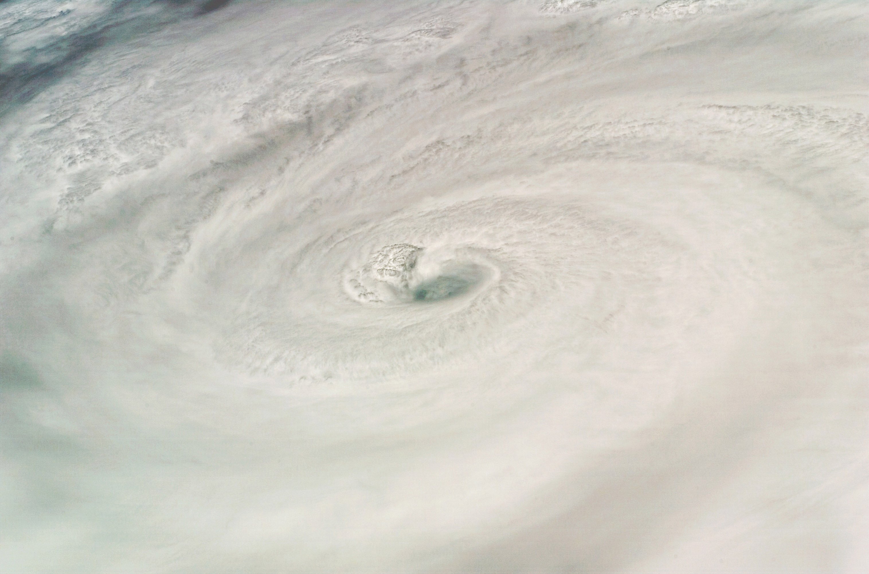
 Picture of Hurricane Dean taken by shuttle Endeavor near peak intensity in the Caribbean Sea.
 EHI values, which is measured by the amount of CAPE and storm relative helicity (in this case the lowest 1km), are above 5 for eastern Nebraska. In general, 0-1km EHI's above 2 can support a decent tornado threat.
 A weather watch, possibly a tornado watch, may be needed later this afternoon for the affected areas.


 Models are beginning to show increased tropical cyclone activity in the Atlantic Basin over the next few weeks. Not to say one model will verify over another, but the consensus of the upcoming pattern is quite similar. Above, NAM shows a system located near the Yucitan peninsula. Below, the CMC has had a similar feature for a couple of runs now.
The GFS on the other hand, does not pick up on this potential system but has been consistent with something developing off the African coast sometime next week.

A look at the Atlantic Basin now shows some convection in the Carribean and some convergence along about 10N.


